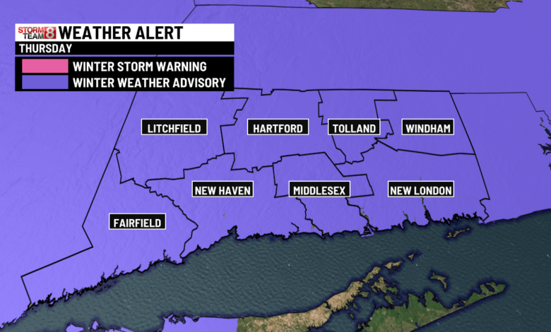
It will be noticeably colder today. Despite more sunshine, highs will only top out in the low 30s. Since there will still be a breeze, wind chills will be in the teens and 20s. A very messy system on the way for Thursday. Expect increasing clouds tonight with snow developing by daybreak. (Solid chance schools will be closed.) We will likely pick up 1″ to 3″ across the state before the snow switches to sleet and/or freezing rain. Of course, that freezing rain will put a glaze of ice on everything–driving could be hazardous in the afternoon and evening. ANOTHER tricky storm is looming for Saturday night–another snow to wintry mix situation.
Today is National Weatherperson’s Day, commemorating the birth of John Jeffries in 1744. Jeffries, a Boston physician and one of America’s first weather observers, began taking weather observations in Boston in 1774.

Today: Cold sunshine. Highs in the low 30s, wind chills in the teens and 20s.

Tonight: Becoming cloudy. Snow developing by daybreak. Lows in the teens and 20s.
Thursday: Snow starting during the morning commute. 1″ to 3″ of snow expected before a switch to sleet and/or freezing rain. A glaze of ice on top of the snow will make the roads hazardous! Wintry weather ending by mid-afternoon. Highs in the mid to upper 30s.


Friday: Mostly sunny with highs near 40°.
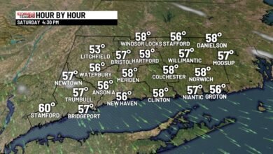
Saturday: Increasing clouds with highs in the mid 30s. Snow will arrive during the evening hours, then change to an icy mix overnight.
Sunday: Icy mix early, then drying out. Highs in the mid 30s to near 40°. No weather problems for Super Bowl plans.
Monday: Mostly sunny with highs in the low to mid 30s.
Tuesday: Watching for possible snow. Highs in the low 30s.
Wednesday: Watching for another chance of snow. Highs in the low 30s.
Source link