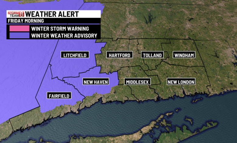
From the 40s and 50s back to the 30s today. It’ll remain a bit breezy this afternoon, so at times it may feel like it’s in the 20s. Clouds will increase tonight, and by morning, we will be tracking some steady rain across most of the state. In the higher elevations of Litchfield, Fairfield, and New Haven Co, there could be an icy mix to start. A WINTER WEATHER ADIVSORY will be in effect for the morning. Overall, expect a soggy Friday with highs in the low to mid 40s. Saturday and Sunday look fine. More rain/snow is possible Sunday night.

This Afternoon: Sun and clouds. A slight breeze. Colder, highs in the upper 20s to mid 30s.

Tonight: Becoming cloudy. Rain/icy mix by daybreak. Lows in the 20s to about 30°.
Friday: An initial icy mix in the higher elevations. On/off rain. Highs in the low to mid 40s.


Saturday: Icy patches early. Scattered clouds with highs in the mid to upper 30s.

Sunday (Groundhog Day): More clouds with highs in the mid to upper 30s. Rain/mix overnight.
Monday: Partial sunshine. Mild, highs near 50°.
Tuesday: Mostly sunny. Colder, highs in the mid to upper 30s.
Wednesday: Partly sunny with highs in the upper 30s.
Thursday: Watching for rain and/or wintry mix. Highs in the low to mid 40s.
Source link