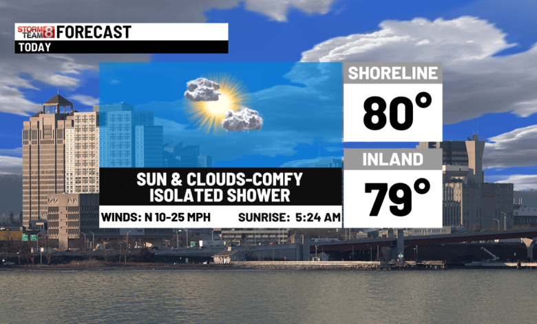
Welcome to July! Refreshing air is coming in on a northerly wind today. An isolated shower is possible, but much of the day will be dry and high pressure builds in with nice weather through midweek.
The humidity ramps up around the fourth with the typical summer pop-up storm threat. Some more widespread showers and storms are possible Saturday.
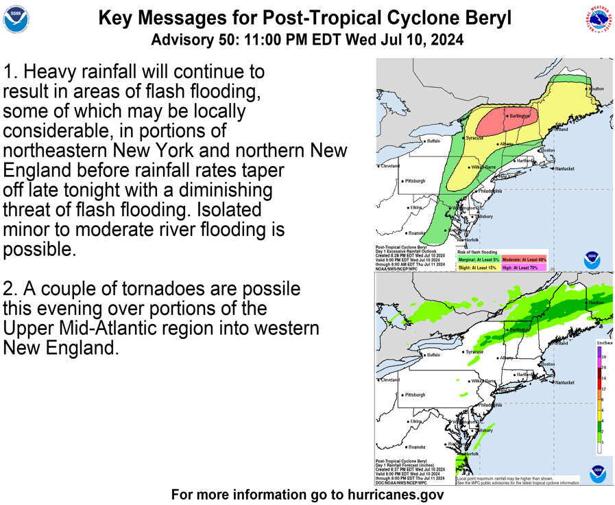
We are watching Major Hurricane Beryl heading for the Windward Islands & Caribbean with another two systems in the Atlantic for your tropical weather scene.

Today: Sun & clouds with an isolated sprinkle or brief shower. Cooler, breezy and much less humid. Highs in the upper 70s to around 80.

Tonight: Clear, comfortable & cool! Lows in the 50s to around 60.
Tomorrow: Sun & high clouds. Highs 80-85 with low humidity.

Wednesday: Partly to mostly sunny & warm with the humidity rising. Highs 85-90.

4th of July: Partly sunny, hazy, hot & humid. A pop-up late-day thunderstorm is possible. Highs 85 to 90.
Friday: Sun & clouds with an isolated pop-up storms. highs in the 80s.
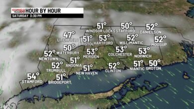
Saturday: Sun and clouds with some showers & storms. Highs in the mid 80s.
Sunday: Warm and humid with some storms possible. Highs in the upper 80s.
Monday: Mainly sunny & less humid highs in the mid 80s.
Source link